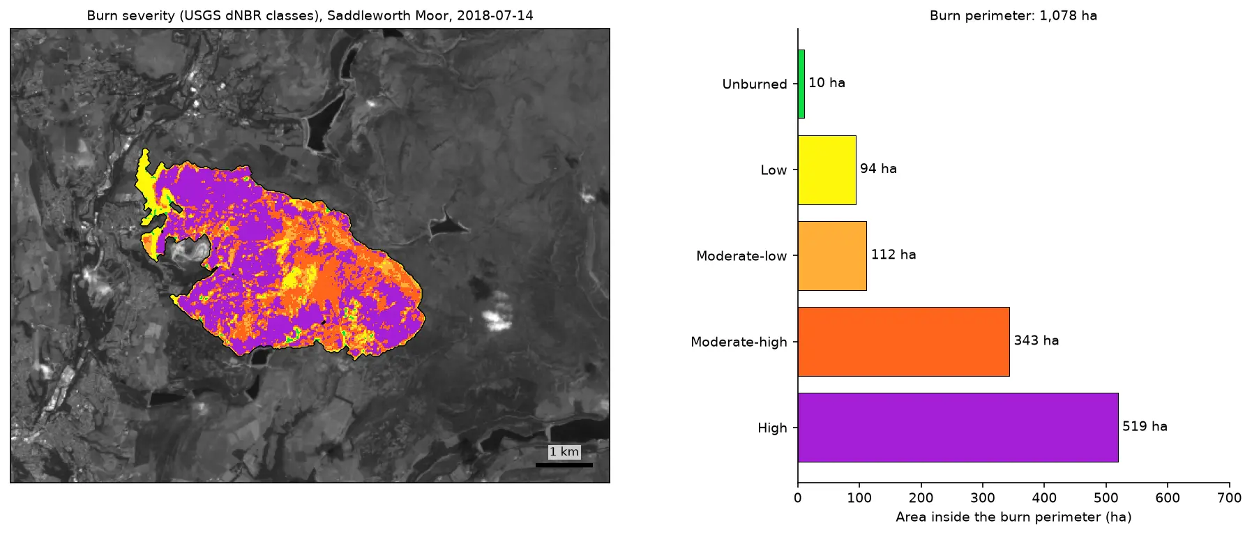
Burn severity mapping with Sentinel-2 and dNBR in Python (Saddleworth Moor 2018)
Map wildfire burn severity in Python with free Sentinel-2 imagery: NBR calculation, cloud and water masking with SCL, dNBR with an offset, USGS severity classes and burned hectares, a burn perimeter, fire progression, RdNBR and an eight-year recovery record for the 2018 Saddleworth Moor fire.