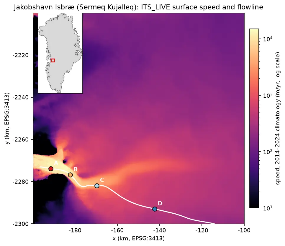
Glacier velocity in Python with NASA ITS_LIVE: Jakobshavn Isbræ, 1985–2025
Map glacier velocity in Python with NASA's ITS_LIVE Zarr datacubes on AWS, with no login: velocity maps, a flowline traced from the velocity field, 40 years of speed profiles, seasonal and multi-year time series from 80,568 filtered image pairs, and strain rates and flow directions on Jakobshavn Isbræ (Sermeq Kujalleq), Greenland's fastest glacier.