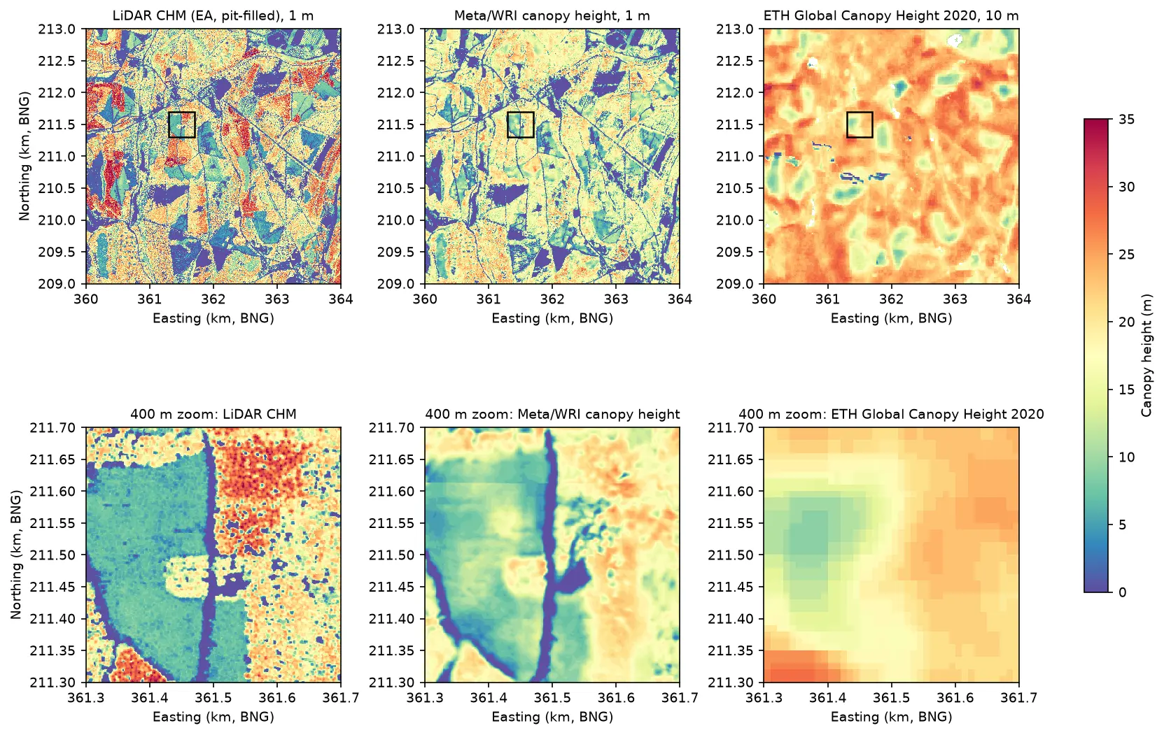
Canopy height map in Python: Meta 1 m and ETH 10 m maps checked against UK LiDAR (Forest of Dean)
Read the open Meta/WRI global 1 m canopy height map from AWS with no login, compare it with ETH Global Canopy Height 2020, and validate both against a canopy height model made from Environment Agency LiDAR in the Forest of Dean: CRS alignment, bias, RMSE, hexbin plots, height classes and honest limitations.