#Cryosphere

2 posts

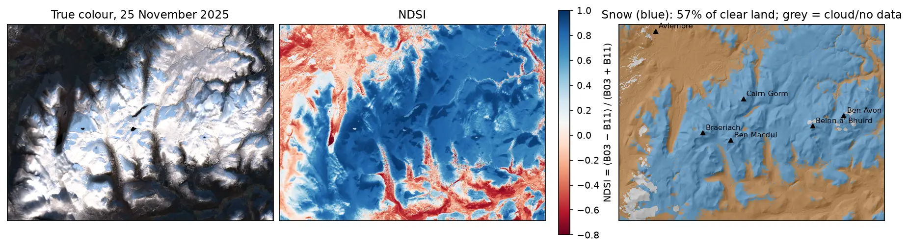
Three panels of the Cairngorms on 25 November 2025: a true-colour Sentinel-2 image with snow on the plateaux and long shadows in the glens; the NDSI, blue over snow and red over forest and bare ground; and a snow map over hillshade, with snow in blue on the high ground around Cairn Gorm, Ben Macdui, Braeriach, Beinn a' Bhuird and Ben Avon, covering 57% of the clear land.

Tutorial Python

Snow cover mapping with NDSI in Python: Sentinel-2 and MODIS over the Cairngorms

Map snow cover in Python with the Normalised Difference Snow Index (NDSI) from Sentinel-2 and the daily MODIS snow product on the Microsoft Planetary Computer: choosing the NDSI threshold, separating snow from cloud, snow-covered area through the winter of 2025–26 in the Cairngorms, and the snowline by elevation and aspect with the Copernicus DEM.
Intermediate 15 min read

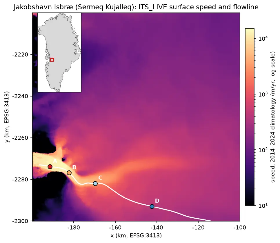
Map of ITS_LIVE surface speed around Jakobshavn Isbræ on a logarithmic colour scale: a narrow channel of ice faster than 10 km per year runs west into the fjord, fed by a broad fan of slower ice from the ice sheet. A white flowline runs up the trunk with points A to D marked at 5, 15, 30 and 60 km, and an inset shows the location on the west coast of Greenland.

Tutorial Python

Glacier velocity in Python with NASA ITS_LIVE: Jakobshavn Isbræ, 1985–2025

Map glacier velocity in Python with NASA's ITS_LIVE Zarr datacubes on AWS, with no login: velocity maps, a flowline traced from the velocity field, 40 years of speed profiles, seasonal and multi-year time series from 80,568 filtered image pairs, and strain rates and flow directions on Jakobshavn Isbræ (Sermeq Kujalleq), Greenland's fastest glacier.

Advanced 15 min read