#QGIS map tips

1 post

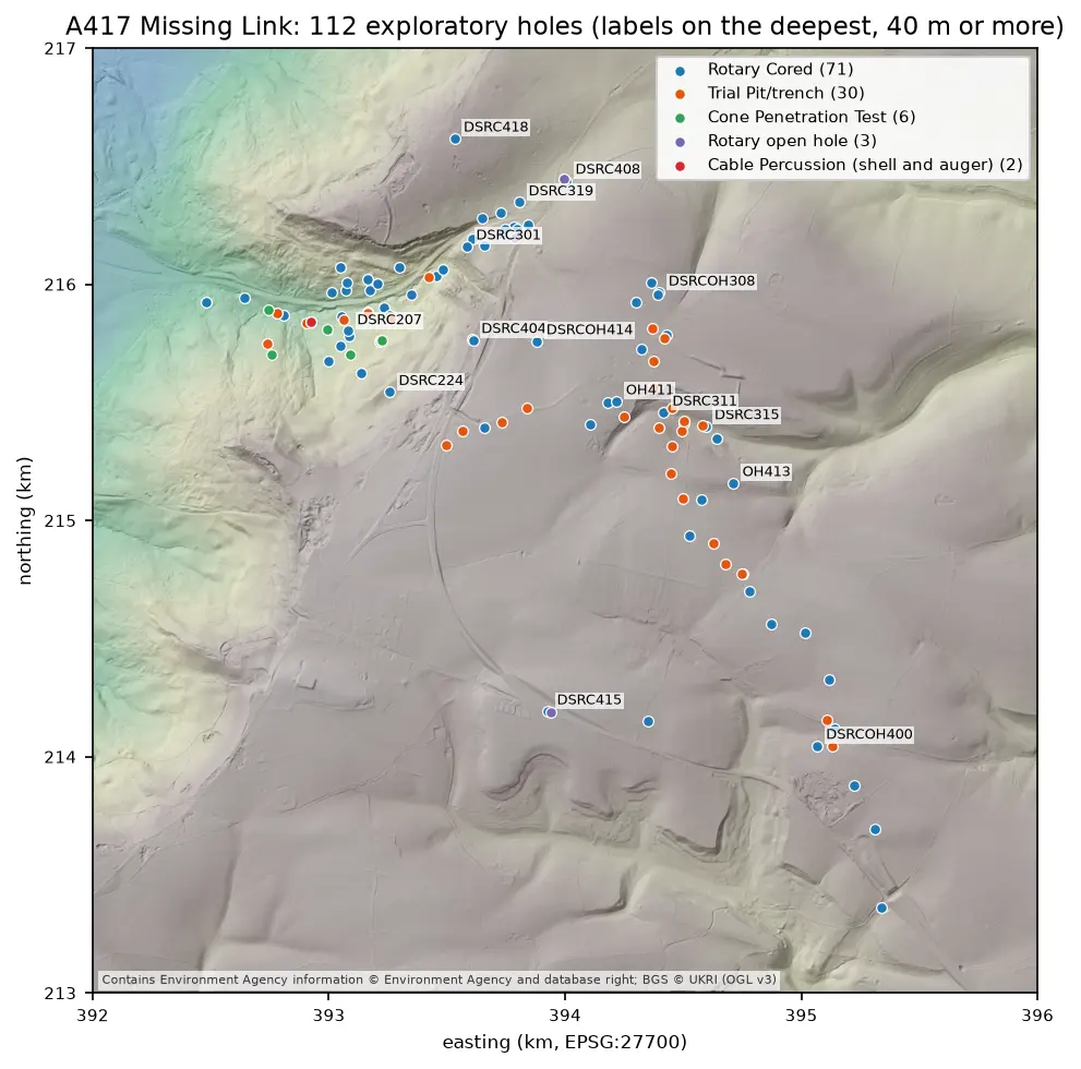
Map of the A417 Missing Link ground investigation on a grey LIDAR hillshade: 112 coloured points for rotary cored boreholes, trial pits, cone penetration tests, open holes and cable percussion boreholes, strung along the road corridor from the vale in the north-west, up the escarpment and south-east across the plateau, with the deepest holes labelled.

Tutorial Python Part 2 of 7

Boreholes on a map: AGS4 locations in British National Grid with QGIS

Turn the LOCA group of a real AGS4 file into points in British National Grid, see what happens when the CRS is wrong, summarise each hole's geology from GEOL, check every ground level against Environment Agency LIDAR, and build a QGIS project with labels and a map tip that shows the borehole log.

Intermediate 8 min read