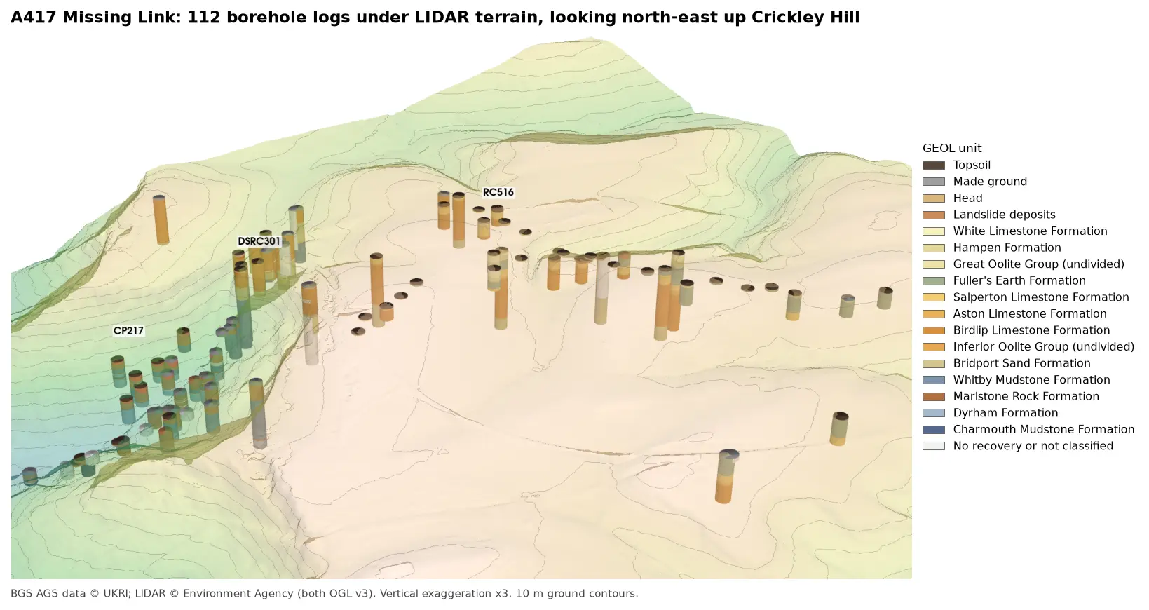
3D borehole logs from AGS4 data in PyVista and QGIS
Build every borehole log in a real AGS4 file as coloured 3D cylinders at their true elevation under Environment Agency LIDAR terrain with PyVista, then style the same intervals in the QGIS 3D map view. Along the way, test whether neighbouring logs agree, and find a block of ground at the top of Crickley Hill where they don't.