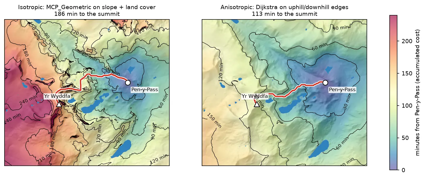
Least-cost path analysis in Python: cost surfaces and walking routes up Yr Wyddfa
Build a walking cost surface from real slope (Copernicus GLO-30) and land cover (ESA WorldCover), compute the accumulated cost surface and the least-cost path with scikit-image's MCP_Geometric, add a direction-aware Dijkstra version with SciPy, and compare the routes with the straight line and the OpenStreetMap footpaths from Pen-y-Pass to the summit of Yr Wyddfa (Snowdon).