#LightGBM

3 posts

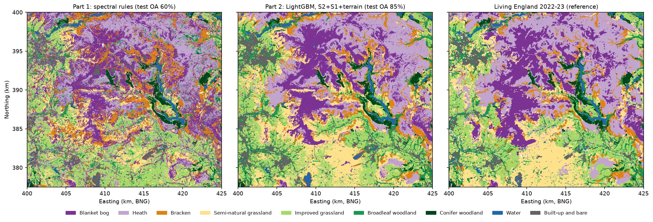
Three habitat maps of the Dark Peak side by side. Left: the noisy Part 1 rule-based map. Centre: the LightGBM map, with smooth purple blanket bog on the Kinder and Bleaklow plateaux, lilac heath around them, orange bracken on the valley sides, yellow semi-natural grassland in the south, green grassland and woodland in the valleys and blue reservoirs. Right: Living England 2022-23, which the LightGBM map closely resembles.

Tutorial Python Part 2 of 5

Habitat classification with LightGBM in Python: Sentinel-2, Sentinel-1 and terrain fusion

Classify nine upland habitats in the Peak District with LightGBM on 77 multi-temporal features: seasonal Sentinel-2 bands and indices, Sentinel-1 VV and VH backscatter and Copernicus DEM terrain. Tune with spatial-fold cross-validation and class weights, run an S2 / S2+S1 / S2+S1+terrain ablation, explain the model with TreeSHAP and permutation importance, and compare it with a random forest and the Part 1 rules on the same test blocks.
Intermediate 21 min read

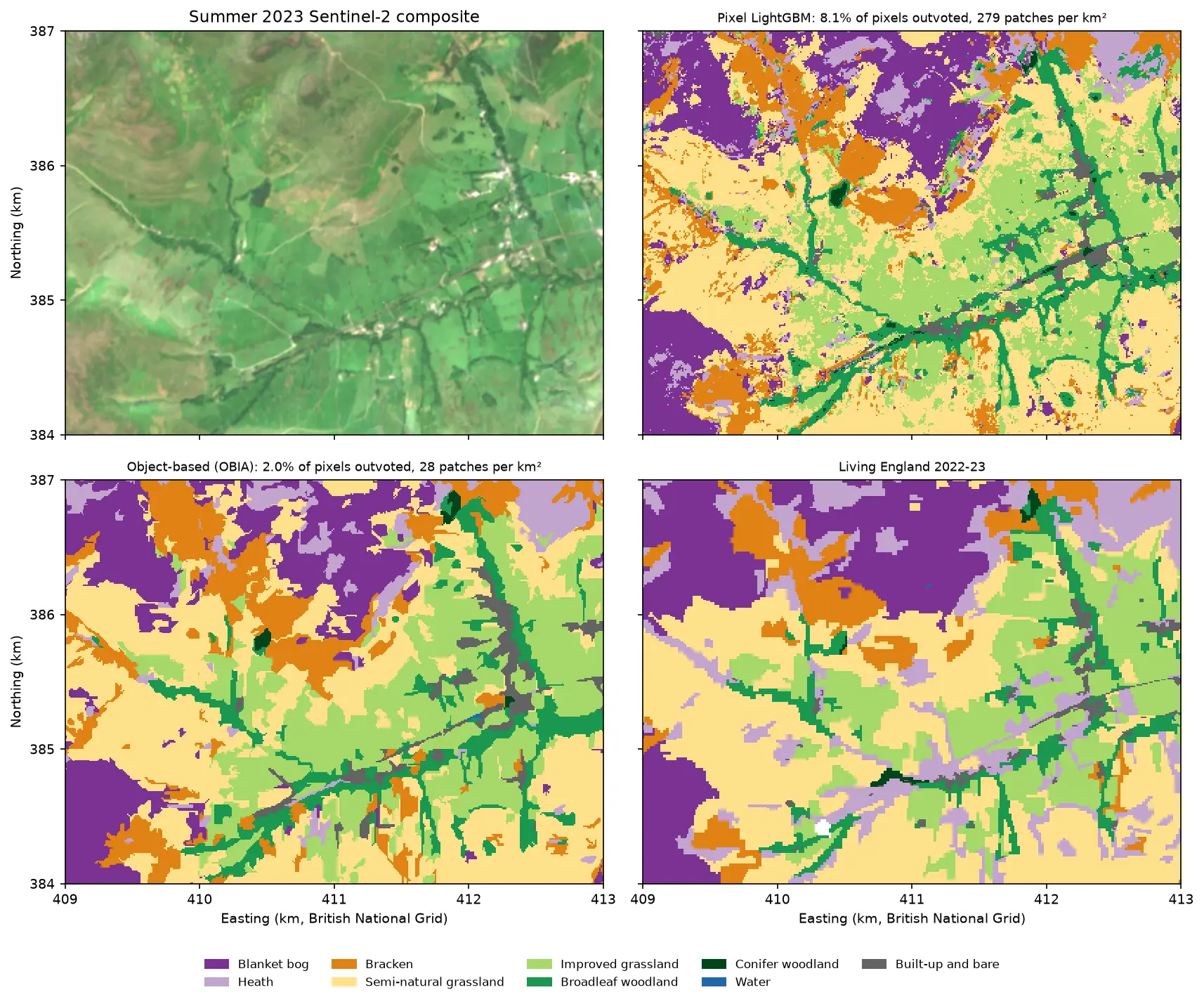
Four panels of the same 4 by 3 km area of the Edale valley and the southern edge of Kinder Scout. Top left: a true colour Sentinel-2 image of green fields and brown moorland. Top right: a pixel-based habitat map speckled with isolated pixels of other classes. Bottom left: the object-based map, with the same habitats in clean patches that follow field boundaries. Bottom right: the Living England reference map.

Tutorial Python Part 3 of 5

Object-based image analysis in Python: OBIA habitat classification with Sentinel-2

Segment 2023 Sentinel-2 seasonal composites of the Peak District into image objects with scikit-image SLIC and Felzenszwalb, tune the segment size against Living England boundaries, compute per-object statistics, shape and GLCM texture with NumPy, classify the objects with LightGBM and compare OBIA with a pixel-based classifier on accuracy, salt-and-pepper noise and patch counts. Then export the habitat objects as GeoPackage polygons.

Advanced 21 min read

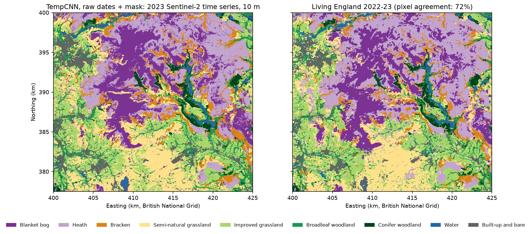
Two habitat maps of the Dark Peak side by side. Left: the TempCNN time-series map at 10 m, with purple blanket bog on the Kinder and Bleaklow plateaux, lilac heath around it, orange bracken on valley sides, yellow and green grassland in the south and west, dark green conifers and blue reservoirs in the Derwent valley. Right: Living England 2022-23 for the same area, which looks very similar but has more heath.

Tutorial Python Part 4 of 5

Satellite image time series classification with deep learning: TempCNN and L-TAE in PyTorch on a CPU

Classify habitats from a full year of cloudy, irregular Sentinel-2 observations with two temporal neural networks in PyTorch: a 1D convolutional TempCNN and a lightweight temporal attention encoder (L-TAE) with day-of-year positional encoding. Compare masking with gap-filling, test against a LightGBM baseline on spatial blocks, read which dates matter from attention and occlusion, and predict a wall-to-wall 10 m map on a CPU.

Advanced 24 min read