#QGIS 3D

1 post

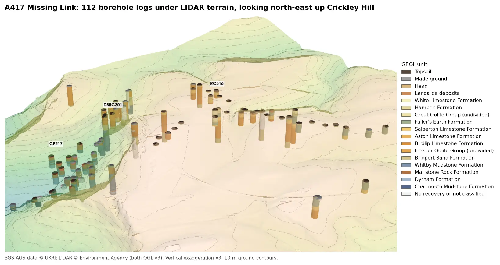
3D view looking north-east up Crickley Hill: LIDAR terrain shaded from green in the vale to buff on the plateau, with 10 m contours, and 112 borehole logs drawn as vertical cylinders coloured by formation. Blue-grey Lias mudstones fill the holes in the vale, orange Inferior Oolite limestones those on the escarpment, and green Fuller's Earth those on the plateau.

Tutorial Python Part 3 of 7

3D borehole logs from AGS4 data in PyVista and QGIS

Build every borehole log in a real AGS4 file as coloured 3D cylinders at their true elevation under Environment Agency LIDAR terrain with PyVista, then style the same intervals in the QGIS 3D map view. Along the way, test whether neighbouring logs agree, and find a block of ground at the top of Crickley Hill where they don't.

Intermediate 12 min read