Warming stripes for London, 1940 to 2025
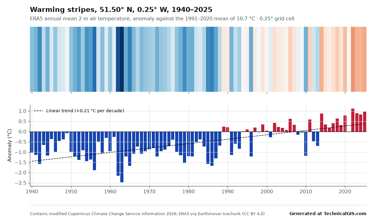
Annual mean temperature anomalies for central London from ERA5, drawn as warming stripes against the 1991 to 2020 mean.
About this output
Warming stripes for the ERA5 grid cell containing central London. Each stripe is one year, coloured by its annual mean 2 m air temperature relative to the 1991 to 2020 average; the lower panel shows the same anomalies as bars with a linear trend.
Credit and reuse
You may reuse this output, including commercially, provided the line "Generated at TechnicalGIS.com" and the following credit are kept with it:
Contains modified Copernicus Climate Change Service information 2026. Neither the European Commission nor ECMWF is responsible for any use that may be made of the Copernicus information or data it contains. Hersbach, H. et al. (2023): ERA5 hourly data on single levels from 1940 to present, Copernicus Climate Change Service (C3S) Climate Data Store, https://doi.org/10.24381/cds.adbb2d47. Accessed through Icechunk ERA5 by Earthmover (CC BY 4.0), https://registry.opendata.aws/earthmover-era5/.
See the output terms and the dataset licence: CC BY 4.0 (Earthmover edition); Copernicus licence (CC BY 4.0) for the underlying ERA5 data.